
Tactile Maps
The 3D printed tactile maps can be used by people with visual impairment to learn how to identify and navigate various types of traffic intersections.
 3D Printing
 1
1 33
33 0
0 2.2k
2.2kDevice Information
Overview
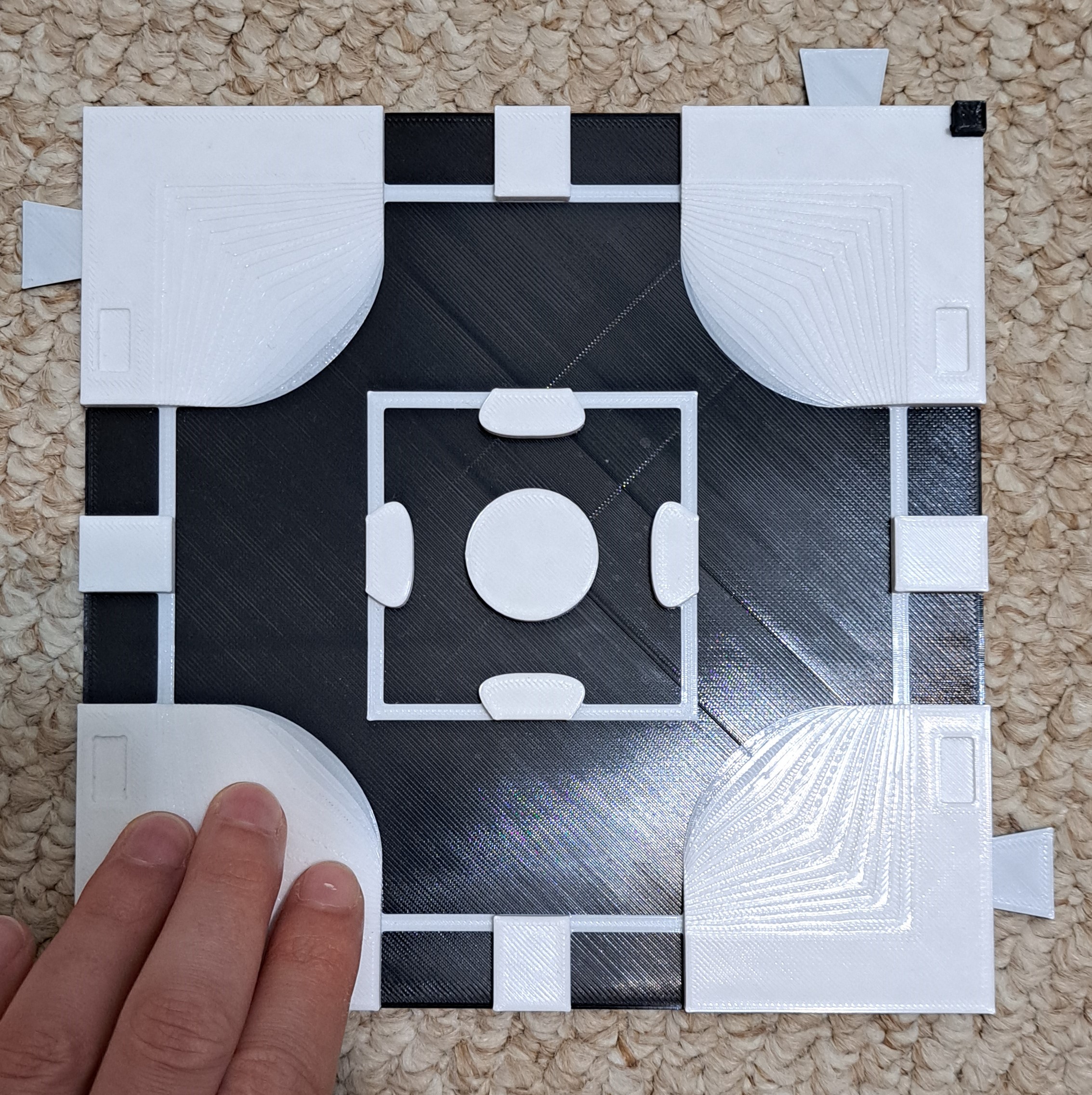
The Tactile Maps are designed to help users with visual impairments learn to navigate different types of intersections with various traffic signs and signals. Maps can be used separately as a learning tool for specific intersections and traffic signs and signals, or can be connected together to plan routes between locations.
Orientation and Mobility (OM) specialists often use tactile maps with their clients, but diagraming tools they use are not given to clients to take home and learn from. We wanted to create general maps of different road intersections that OM specialists could use with clients to teach how to navigate various generic intersections. The maps could be used independently by people with visual impairments to study different types of intersections and can be used by OM specialists with clients.
The legend includes Braille labels for the different representations of traffic signs and signals.
How To Use
Use the map on a surface where it will not slide around as the user runs their hands over the map. If the map has hook and loop tape, the maps can be attached to any surface the hook side will attach to, including carpet or tactile map diagramming kit backboards. Insert the desired traffic sign/signal pieces into the spaces on the tactile maps being used. The pieces should fit snuggly into the cut-outs on the tops of the maps and not get knocked out when running your hand over the features. They should still be easy to remove and change different pieces.
There is a raised square in the top-right corner of the map to help users orient to the direction of the maps. For example, this corner could represent North-East.
A user will run their hands over the maps to feel the different road features, including crosswalk lines, sidewalks/pavement, and traffic signs/signals.
If they are unsure what a feature represents, they can consult the legend if they read Braille.
Disability Type Description
Any user with vision loss may benefit from using the tactile maps with an orientation and mobility specialist to learn how to identify and navigate traffic intersections.
Estimated Cost (CAD)
Maker Information
Skills Description
This build consists entirely of 3D printing parts.
Print Time (hrs)
35.5
Assembly Time (hrs)
0.25
Tools Needed
3D Printer
Build Instructions
The build consists of 3D printing the legend, legend labels, and desired maps and features (stop signs, traffic lights, etc.). The legend labels will need to be placed into their respective locations in the legend, and should fit snuggly into place.
Detailed step-by-step instructions can be found in the Maker Guide.
Project Link
Please login or register to agree to the MMC Terms of Use to access the Project Link
License
Attribution
Reviews

There are no reviews for this device